Written by: Sadeem Shaikh
Posted on: March 29, 2015 | 
A sketch of the Wild Pass of Siri Kajoor, Afghanistan
Mohatta came from the Indian province of Rajasthan and commissioned a Muslim architect, Agha Hussain Ahmed, to build this palace as an everlasting token of love for his dying wife. Ahmed made use of the Indo-Saracenic Revival style to ensure that the palace became his best-known work. However, Mohatta was only able to reside in the palace till Partition. In the words of the Assistant Curator of the Museum, Khalid Soomro, “the Mohatta Palace then became the Foreign Services Office for the newly created country till 1964”. Later, Fatimah Jinnah decided to move into the palace, residing in it until her death in 1967. Her sister, Shireen Jinnah, then took over until her death in 1980. The palace then remained abandoned for nearly 15 years, after which the Government of Sindh decided to restore it.
 |
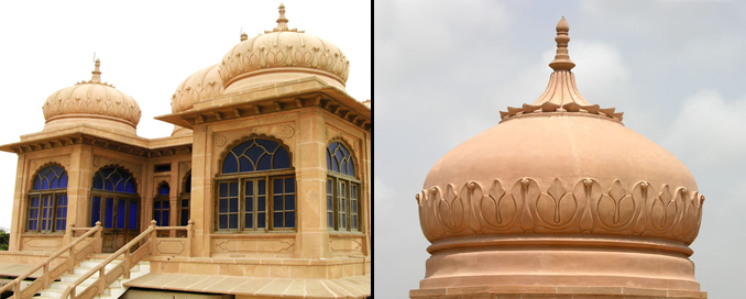
A mesmerizing structure on the palace rooftop One of the dome-shaped tombs of the palace |
Upon entering the plot holding this splendid construction, one is overwhelmed by the effort put into this 20th century landmark. The clay and sandstone exterior is a stunning result of the combination of pink Jodhpur and yellow Gizri stones used. With the countless number of stone brackets, arches, floral motifs, wood carvings and other Indo-Islamic embellishments, the outstanding intricacy of the design is remarkably sustained. Components of the building that stand out are the Jharoka-style windows and octagonal dome-shaped towers. The windows protrude from the walls and are wood-fitted with complex spandrels, balustrades and motifs, designed with a mix of Victorian and Indo-Islamic architecture. The Victorian influences in construction are evident in the stone-carved statues in the alley at the back of the palace, which, according to the museum guide, date back to the late 19th century. The magnificent establishment also features a 5-dome super structure on the rooftop, with blue-tinted windows and a small staircase intended to provide protection to the residents from the summer heat.
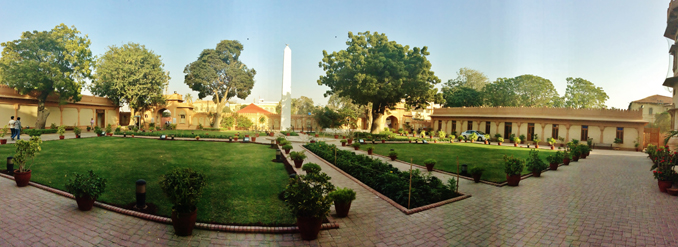
The palace overlooks a beautifully decorated garden with huge trees, colorful plants and a mini-fountain in the center. Seeing the closeness of this structure to the sea and considering the delicate nature of the stones used in its construction, one realizes that the palace has been well-maintained over the years.
 |
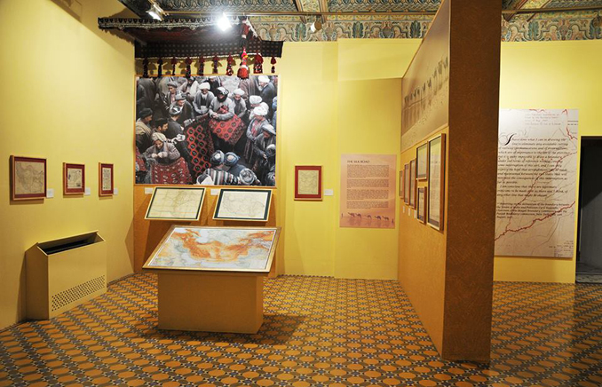
The exhibition of rare maps and prints |
Each year, the Museum hosts a new and engaging exhibition, considered as an annual ritual of sorts. Titled ‘Drawing the Line: Rare Maps and Prints’, the exhibition showcased rare collections of 90 maps and 40 prints of the Indian Subcontinent, Afghanistan, Iran, Central Asia, and other areas surrounding these regions.
The exhibition included two documentary screenings on the Silk Road and the outstanding efforts of ancient mapmakers. The Head Curator of the Museum, Nasreen Askari, agreed that “it is important to do a unique exercise every year, and bring the most significant artifacts to the people”. She identified the main sources of the material displayed as “British museums, the Sindh Archives, and other individuals, such as Jamshed Marker and FS Aijazuddin”. These displays ranged from late 15th century maps of the subcontinent to the latest British-run surveys of the 1940s, making a dreamland for cartographic enthusiasts. The level of detail and depth in these collections demands endless extolment and praise. Although the period was clearly defined to be between 1480 and1947, some earlier topographical accounts of the Indus Delta and the Arabian coast by Alexander the Great (325 BC) were also present. The spectacular fluency in these works clearly demonstrated the tireless efforts of countless mariners, travelers, merchants, pilgrims and administrators who have surveyed these areas through the centuries.
 |
A panoramic view of the palace garden |
Beginning from the global cartographic perceptions of ancient Greeks such as Herodotus and Ptolemy (dating back to 450 BC for the former, and 1482 for the latter), ‘Drawing the Line’ demonstrated a tremendous transformational spirit in the evolutionary nature of the maps displayed. The eleven-part exhibition also featured an enthralling picture of the 1486 publication of Decima Asie Tabula, known to be the earliest map of India, having Greek origins. The historic works of Arabic cartographers such as Al Idrisi and Ibn Al Wardi were also on the walls, the latter depicting the world around the Khana Kaba in a simplistic fashion. Other maps of Sindh (1618-19), Rajputana Principalities (1829) and Northern Punjab (1838) were equally interesting to see.
The exhibition was also well-supplemented with incredible sketches of the Fort of Bukkur and Rohri seen from Sukkur (1841), the Wild Pass of Siri Kajoor (1842), Shrine of Khwaja Khizr (1838) and other sketches from the Mughal period, including an illustrious depiction of the Hazuri Bagh. Finally, James Rennel’s 1788 ‘Map of Hindustan’ or the ‘Mogul Empire’ painted a holistic picture of how people saw the Indian Subcontinent in the late 18th century.
Click to view picture gallery
You may also like: